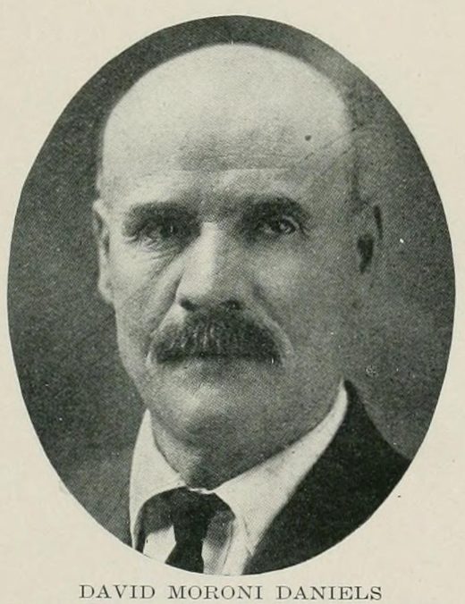
Dave Daniels ranch (by the family account)
1892 · David Moroni Daniels Approximate location
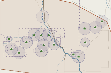
By the family account, Dave Daniels’s ranch stood “above the mouth of West Fork” on Bannock Creek. Bannock Creek flows north here, so “above” probably means upstream (south); the household’s only title, Gertrude Daniels’s 1901 desert-land patent, lies about 1.3 miles south-south-east in Secs. 2–3 T10S R33E (mapped separately). The point is kept where first placed; the house site has not been located. Now within the Fort Hall Reservation.
Gertrude and David M. Daniels desert-land claim, Big Meadows (entry 1895; patent 1901)
July 17, 1895 · Gertrude Grace Dives Daniels, David Moroni Daniels Strongly documented
Gertrude Daniels’s desert-land claim of 1895, patented in 1901: 316 acres in Secs. 2–3 T10S R33E, in the Big Meadows. It was the David M. Daniels household’s only title and probably the site of “the old Daniels ranch” above (upstream of) the mouth of West Fork; the house site itself has not been located. Inside today’s Fort Hall Reservation.
Thomas D. and Sarah Daniels homestead, Pauline (entry 1901; patent 1909)
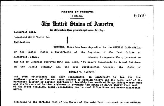
entry March 25, 1901 · Thomas D. Daniels Jr., Sarah Elizabeth Dives Daniels Strongly documented
Thomas D. Daniels’s homestead at the Pauline crossroads, entered March 25, 1901, and patented in 1909: SE¼SE¼ Sec. 12 and NE¼ Sec. 13 T10S R33E with Lot 1 Sec. 18 T10S R34E. The homestead is probably part of the later Sod Williams ranch.
John M. “Donum” Daniels homestead, West Fork (entry 1901; patent 1909)
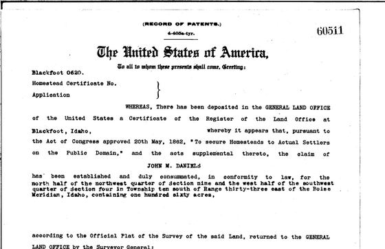
entry March 19, 1901 · John Moroni “Donum” Daniels, Martha Rosetta Richards Daniels Strongly documented
Donum Daniels’s West Fork homestead, entered March 19, 1901, and patented in 1909: SW¼ Sec. 4 and NW¼ Sec. 9 T10S R33E. H. M. Saulsberry had moved onto the place by January 1919. The Sec. 4 part lies inside today’s reservation.
Henry Daniels homestead, West Fork (entry 1901; patent 1909)
entry March 12, 1901 · Henry “Hen” Daniels, Elizabeth “Lizzie” Williams Daniels Strongly documented
Henry Daniels’s West Fork homestead, entered March 12, 1901, and patented in 1909: Sec. 3 and the SE¼ of Sec. 4 T10S R33E. By 1924 the tracts were taxed to J. V. Williams. Inside today’s reservation.
George Daniels homestead and cabin by the West Fork spring (patent 1908)
1908 · George Daniels Sr., Mary May Bolingbroke Daniels Strongly documented
Cold water bubbling up close to the mountain and feeding Bannock Creek. George Daniels’s cabin stood near the spring at the foot of “George’s Mountain”; his homestead (SE¼ Sec. 5 T10S R33E, patent 1908) lay beside it.
Sarah Daniels’s desert-land claim (entry 1901; patent 1908)
entry on March 21, 1901 · Sarah Elizabeth Dives Daniels Strongly documented
Sarah E. Daniels’s 240-acre desert-land claim on Bannock Creek just north-west of the Pauline crossroads: SE¼SW¼ Sec. 2 and NW¼, SW¼NE¼ Sec. 11, T10S R33E, entered on March 21, 1901, and patented on June 8, 1908. In 1907 the family’s 1892 Rattlesnake Creek right was used mainly here, and in 1918 her sons Ray and Verl ran the ranch. Inside today’s reservation boundary.
Walter M. Daniels’s homestead (patent 1913; entry about 1910)
1910 · Walter M. Daniels Approximate location
Walter M. Daniels’s homestead, patented May 3, 1913, lay in Sec. 3 and the NW¼ of Sec. 10, T10S R33E, with a forty in the SE¼ of Sec. 3 bought in 1914. The forties are not known, so the point is the centre of Sec. 3, the section holding most of the land. Inside today’s reservation.
David A. Daniels’s homestead (patent 1913; entry about 1910)
1910 · David Albert Daniels Approximate location
David A. Daniels’s homestead (patent May 1913) and adjoining isolated-tract forty (June 1913) in Sec. 10, T10S R33E. With Claud Price’s 1912 S½S½, Thomas V. Daniels’s N½S½ and Thomas D. Price’s and Walter Daniels’s forties in the NW¼ accounted for, his land was probably the NE¼ with one forty of the E½NW¼. His widow’s farm was rented in 1920. Inside today’s reservation.
Verl Daniels’s homestead (patent 1915; entry about 1912)
1912 · Thomas Veurlam “Verl” Daniels Approximate location
Thomas Veurlam Daniels’s 160-acre homestead in Sec. 10, T10S R33E, patented October 25, 1915. The county recorder’s 1921 list, in poor newspaper copy, reads N½SE¼ and SW¼; since Claud Price’s 1912 patent holds the S½SW¼, the land was probably the N½SE¼ and N½SW¼, where the point is placed. Inside today’s reservation.
Eli and Lillie Daniels’s homestead (patent 1917; entry about 1914)
1914 · Eli Moroni Daniels Approximate location
Eli M. Daniels’s 160-acre homestead in Sec. 8, T10S R33E, patented May 7, 1917 (entry by about 1914). Lewis Reese held land in the SE¼, and the 1920 and 1924 tax lists put 160 acres in the north part of the section (NW¼NE¼ and three forties of the NW¼) under Tom Daniels’s name, possibly this homestead. The point is the section centre. Part of the section lies inside today’s reservation.
Theodore Daniels’s homestead (patent 1915; entry about 1912)
1912 · Theodore “Theo” Daniels Approximate location
Theodore Daniels’s 160-acre homestead in Sec. 32, T9S R34E, north-east of Pauline toward Crystal, patented October 25, 1915. The 1938 USGS map shows the Armstrong school in this section. Outside today’s reservation.
Earl Daniels’s homestead (patent 1916; entry about 1913)
1913 · Earl Richards Daniels Approximate location
Earl R. Daniels’s 169-acre homestead in Sec. 31, T9S R34E and Sec. 6, T10S R34E, patented September 13, 1916. The east part of Sec. 31 was patented to Lorenzo L. Reese and Robert Wheatley, so the point is placed where the west halves of the two sections meet. Outside today’s reservation.
Ray Daniels’s homestead (patent 1917; entry about 1914)
1914 · Raymond “Ray” Daniels Strongly documented
Raymond Daniels’s homestead, patented January 27, 1917: SW¼SE¼ Sec. 6 and Lot 1, NE¼NW¼, NW¼NE¼ Sec. 7, T10S R34E, beside the Bolingbroke land. The forties are those listed under Earl R. Daniels’s name in the 1925 delinquent-tax notice, which add up exactly to the patent’s 152.97 acres.
Lou Reese’s homestead (patent 1917; entry about 1914)
1914 · Lewis Lorenzo “Lou” Reese Approximate location
Lou Reese’s 160-acre homestead in the SE¼ of Sec. 8 and the SW¼ of Sec. 9, T10S R33E, patented May 7, 1917 (entry by about 1914), beside Eli Daniels’s land. The forties are not known; the point is on the line between the two quarters.
Lorenzo L. Reese’s homestead, probably Elva Daniels’s husband (patent 1917; entry about 1914)
1914 Approximate location
A 156-acre homestead in the SE¼ of Sec. 31 and SW¼ of Sec. 32, T9S R34E, and the NW¼ of Sec. 5, T10S R34E, patented June 28, 1917, to Lorenzo L. Reese, probably Elva Daniels’s husband. The forties are not known; the point is central to the three quarters.
Lavina Thomas’s forty (patent 1913; entry about 1910)
1910 · Lavina Daniels Thomas Strongly documented
The SW¼SE¼ of Sec. 12, T10S R33E, patented September 24, 1913, to Lavina D. Thomas, Thomas D. Daniels’s daughter, on a claim begun by her late husband William M. Thomas; it adjoins her father’s homestead, and 19 of its acres are now watered by the 1892 Daniels right.