Pauline & West Fork
At the northern end of the valley, follow the stories of Pauline, West Fork and Big Meadows, their school, store, post office, and community life.
Read the history of Pauline & West Fork ↗Get to know the five communities remembered in these accounts: Pauline and West Fork, Crystal, Arbon, Summit, and Buist.
Written for the original ArbonValley.com by Melinda Campbell. Memories and documents quoted in the account belong to the people who wrote them. This is the website publication date, not the date of every event described. References to “today” belong to the original account.
Editorial introductions and navigation were added in September 2026. Original citations remain in the account. How we preserve and annotate the history ↗
Choose an area to follow its history.
At the northern end of the valley, follow the stories of Pauline, West Fork and Big Meadows, their school, store, post office, and community life.
Read the history of Pauline & West Fork ↗A high basin of springs and creeks, remembered through its homesteads, schoolhouses, store, and post office.
Read the history of Crystal ↗Explore the older Arbon community, irrigation work, homesteads, and the origins of the name now used for the wider valley.
Read the history of Arbon ↗The high part of the valley between Arbon and Buist: Jenson Pass, Bull Canyon, dry farming, and the roads that connected families to markets.
Read the history of Summit ↗At the southern end of the valley, discover the Buist community and its farms, school, and post office.
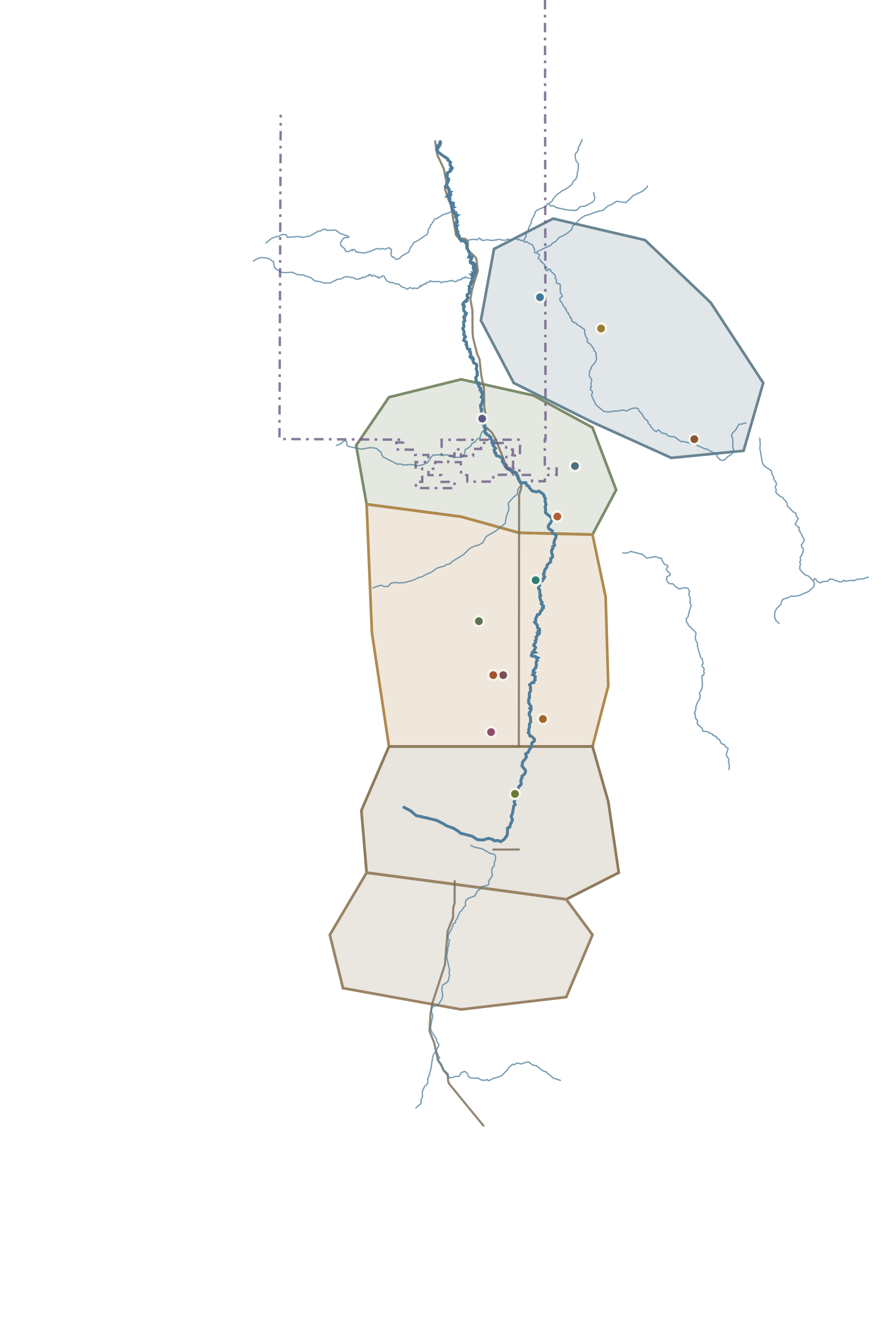
Read the history of Buist ↗Areas and homesteads from the valley map, drawn from the archive’s accounts. Outlines and positions are approximate; this is a reading guide, not a road or property map. View the original family map ↗
Explore the older Arbon community, irrigation work, homesteads, and the origins of the name now used for the wider valley.
Explore Arbon ↗At the southern end of the valley, discover the Buist community and its farms, school, and post office.
Explore Buist ↗A high basin of springs and creeks, remembered through its homesteads, schoolhouses, store, and post office.
Explore Crystal ↗At the northern end of the valley, follow the stories of Pauline, West Fork and Big Meadows, their school, store, post office, and community life.
Explore Pauline and West Fork ↗The high part of the valley between Arbon and Buist: Jenson Pass, Bull Canyon, dry farming, and the roads that connected families to markets.
Explore Summit ↗What is known as Arbon Valley today was once known as Bannock Valley. There used to be several distinct areas. These were Arbon, Buist, Crystal, Pauline (including West Fork), and Summit.
The following information comes from the wonderful book by Laurie Jean Ward (now Call), titled Bannock Valley. Laurie wrote this at the mature age of twenty-two, publishing it in 1982. She did the research and all the hard work, and gave the Arbon Valley Homestead Project permission to glean her hard work.